
")


Efficient Rainfall Situation in Seville
Why does it sometimes rain in Seville what should rain in 3 months... in just 24 hours? The answer lies in an exceptional meteorological configuration that combines deep low-pressure systems, subtropical atmospheric rivers, and cold troughs. In this guide, you'll learn what these phenomena are, how they form, and why they can transform Seville's dry climate into a scenario of devastating floods.
Seville's Rainfall Challenge
Seville has a continental Mediterranean climate:
- 🌞 Very dry summers (June-September: almost 0 mm)
- ☔ Annual precipitation: 500-600 mm (modest)
- 📉 Rainfall concentrated in autumn-winter
- ⚡ Rain episodes normally short (a few hours)
But occasionally something extraordinary happens: 100-200 liters/m² in 24-48 hours. That's more than what usually rains in 3-4 normal months... in a single day!
What is an Atmospheric River?
An atmospheric river is a narrow band of concentrated moisture that flows through the atmosphere like a river flows on land, but in the sky.

Characteristics of an Atmospheric River
Dimensions:
- Length: 2000-3000 km (from the tropical Atlantic to Spain!)
- Width: 400-600 km (narrow, concentrated)
- Height: 2-3 km from the surface
Content:
- Humidity: 80-95% (almost total saturation)
- Precipitable water content: 2-3 cm
- Temperature: 15-25°C (warm subtropical air)
Transport:
- Speed: 50-80 km/h (SW/S winds)
- Water flow: 15 times the Mississippi River
- Origin: Tropical Atlantic/Azores
How Does It Work?
- Massive evaporation: The tropical Atlantic (25-28°C) evaporates enormous amounts of water
- Channeling: Strong SW winds organize that moisture into a narrow "band"
- Transport: Acts as a "hose" pumping subtropical moisture toward Europe
- Discharge: When it collides with a cold trough or mountains, it discharges all the water as torrential rain
The Ideal Synoptic Configuration for Seville
For an atmospheric river to discharge over Seville, several ingredients need to work together:

INGREDIENT 1: Deep Low-Pressure System to the West/Southwest
Necessary characteristics:
- Position: Atlantic, between 35-40°N and 15-20°W (west of Portugal)
- Depth: Less than 970 hPa (VERY deep low)
- Movement: Slow or stationary (must not pass quickly)
Its function:
The low-pressure system acts as a "suction pump" that channels the atmospheric river from the tropics toward Andalusia. The deeper it is, the stronger the suction.
INGREDIENT 2: Subtropical Atmospheric River
Origin and trajectory:
- Origin: Tropical Atlantic (15-25°N) or Azores region
- Route: From the SW, entering through the Gulf of Cádiz
- Duration: Must remain active 24-72 hours
Why is it so humid?
It comes from tropical latitudes where water is at 25-28°C, allowing massive evaporation. It's SUBTROPICAL air, much more humid than normal Atlantic air.
INGREDIENT 3: Strong South/Southwest Winds
Speed and persistence:
- Sustained speed: 40-70 km/h
- Gusts: Can exceed 100 km/h
- Direction: From south or southwest (180-240°)
- Persistence: At least 24 continuous hours
Its crucial role:
They act as the "engine" that continuously injects warm subtropical moisture over Seville. Without strong and persistent wind, the atmospheric river doesn't arrive or dissipates.
INGREDIENT 4: Cold Trough Aloft
Characteristics:
- Altitude: 5-9 km above sea level
- Temperature: -15°C to -25°C (polar/arctic air)
- Position: Over the Peninsula or just to the west
Why is it essential?
Creates a brutal thermal contrast:
- Surface: +20°C (humid subtropical air)
- 5 km up: -15°C (dry polar air)
- Difference: 35°C vertically
This contrast generates extreme instability: warm air rises violently, condenses all its moisture, and produces intense storms.
INGREDIENT 5: Persistence (Blocking)
The time factor:
The configuration must remain STABLE for 24-72 hours. This occurs when:
- Blocked circulation pattern (typical omega block)
- High pressure to the north that "brakes" the low
- The low moves VERY slowly or is almost stationary
If the low crosses quickly (as usually happens), it will only rain for a few hours. To accumulate 100-200 L/m², you need intense rain for 24-48h.
Why Is This Configuration So Powerful?
The "perfect recipe" combines three multiplicative factors:
1. Maximum Moisture (Atmospheric River)
The atmospheric river brings air with 2-3 cm of precipitable water. That means if ALL the water in the air fell, there would be 20-30 mm on the ground. But as the wind keeps bringing more humid air continuously, the total can be 100-200 mm.
2. Maximum Instability (Cold Trough)
The vertical thermal contrast generates updrafts of 20-30 m/s (72-108 km/h upward!). These currents "suck" the humid air from below, cool it abruptly, and convert it to torrential rain.
3. Continuous Dynamic Forcing (Low-Pressure System)
The deep low acts as a "pump" that doesn't stop sucking humid air from the south. As long as the low is there, the moisture flow continues.
Types of Atlantic Low-Pressure Systems Affecting Seville
The low-pressure systems that generate torrential rains in Seville always come from the Atlantic, as Seville is in the Guadalquivir valley completely open toward the ocean. Several types exist:

Classic Deep Atlantic Lows
Characteristics:
- Central pressure: 960-980 hPa (very deep)
- Ideal position: SW of Portugal (35-40°N, 15-20°W)
- Movement: Slow or almost stationary
- Duration: 24-72 hours affecting the region
- Winds: From south/southwest sustained 50-80 km/h
Why are they so effective?
Their position to the southwest perfectly channels the humid subtropical flow directly toward the Guadalquivir valley. The deeper and slower, the more persistent the moisture flow.
Lows with Intense Atmospheric River
The most dangerous scenario:
- Atlantic low connected to a subtropical moisture band
- Atmospheric river of 2000-3000 km length
- Continuous transport of saturated tropical air
- Accumulations can exceed 150-200 mm in 48h
Historical examples:
- December 1876: The Great Flood - 5-day atmospheric river
- January 2010: 120 mm in 24h with intense atmospheric river
- December 2009: Series of atmospheric rivers for weeks
Atlantic Explosive Cyclogenesis
What is it?
A low-pressure system that intensifies very rapidly (>24 hPa in 24 hours). Although they usually pass quickly, if they slow down near Iberia they can be devastating.
Danger signs:
- Pressure dropping >3 hPa per hour
- Winds increasing from 30 to 80 km/h in a few hours
- Development of very organized precipitation bands
- Typical in autumn-winter in the North Atlantic
Trains of Lows
Prolonged rain episodes:
Sometimes it's not a single low, but several in succession that maintain rains for weeks:
- Blocked circulation pattern over the Atlantic
- Low after low passing through the same area
- Monthly accumulations exceeding 300-400 mm
- Risk of floods due to soil saturation
Example: Winter 2009-2010 - Continuous series of Atlantic lows during December-January.
Historical Episodes in Seville
When the ideal configuration occurs, Seville can suffer devastating floods:
December 1876 - The Great Flood
Seville's worst hydrological disaster:
- Guadalquivir massively overflowed
- Entire city flooded (15% of urban area under water)
- Configuration: Deep Atlantic low + subtropical atmospheric river
- Torrential rains for 5 consecutive days
- Thousands affected, enormous economic losses
November 1961 - The Sixties Floods
Characteristics:
- 150-200 mm in 48 hours in some areas
- SW winds sustained at 60-80 km/h
- Stationary low west of Portugal
- Floods in Seville's low-lying neighborhoods
December 2009-2010 - The Wet Winter
Prolonged episode:
- Series of deep Atlantic lows
- Multiple atmospheric rivers for weeks
- Accumulations exceeding 300 mm in the quarter
- Guadalquivir at capacity limit
January 2010 - The Deluge
One of the rainiest days:
- 120 mm in 24 hours in Seville city
- Perfect configuration: deep trough + atmospheric river
- South winds at 70 km/h with gusts of 100 km/h
- Persistent storms with hail
- Floods throughout the city
How to Predict These Episodes?
Meteorologists look for this sequence in models:
With 5-7 Days Lead Time
- 🔍 Look for: Deep low forming in mid-Atlantic
- 🔍 Verify: Is it moving toward Iberia?
- 🔍 Analyze: Integrated moisture fields (IWV > 25 mm = atmospheric river)
With 2-3 Days Lead Time
- ✅ Confirm position: Low SW of Portugal
- ✅ Verify atmospheric river: Subtropical moisture band visible?
- ✅ Analyze trough: Cold air aloft over Peninsula?
- ✅ Speed: Moving slowly? (If yes = more dangerous)
With 12-24 Hours Lead Time
- ⚠️ Surface winds: From south/southwest at 40+ km/h?
- ⚠️ Satellite: Subtropical cloud band visible?
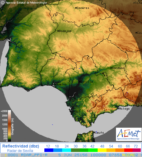
- ⚠️ Radar: First storms forming?
- ⚠️ AEMET warnings: Orange or red for rain?
- Water vapor satellite: Shows the atmospheric river band
- IWV maps (integrated water): Values >25-30 mm indicate atmospheric river
- ECMWF model: Best for predicting Atlantic lows
- Atmospheric soundings: Show vertical thermal contrast
Signs in the Sky (Direct Observation)
If you're in Seville and see this, prepare yourself:
12-24 hours before:
- Constant warm south/southwest wind
- Temperature higher than normal for the season
- High humidity (>80%) - "sticky" feeling
- Pressure dropping rapidly (>3 hPa in 3 hours)
- Sky covered with altostratus from SW
Hours before:
- Very strong SE/S wind (gusts >60 km/h)
- Cumulonimbus developing to SW/W
- Distant thunder audible
- Very dark sky from the west
It's here!
- Torrential rain (>10 mm/hour)
- Continuous storms
- Very strong wind with abrupt changes
- Can last 12-48 hours
Climate Change Impact
Global warming is affecting these events:
Observed Changes
- 📈 Warmer Atlantic: +1-2°C compared to 1900 = more evaporation
- 📈 More humid atmosphere: +7% humidity per °C = more intense atmospheric rivers
- 📈 More intense events: When it rains, it rains HARDER
- 📉 Less frequent but worse: Fewer episodes but more extreme
Future Projections
Climate models predict for 2050-2100:
- Atmospheric rivers 25% more intense
- Episodes of 150+ mm/day more frequent
- But also longer dry periods between episodes
Conclusion
Atmospheric rivers and ideal synoptic configurations are responsible for the most intense rainfall that Seville can experience. Although Seville's climate is mostly dry, when all ingredients align perfectly, the city can receive more rain in 24-48 hours than in complete months.
Understanding these phenomena allows:
- Better interpretation of weather forecasts
- Preparation days in advance
- Understanding why some events are so devastating
- Appreciation of atmospheric complexity
💡 Remember: Next time you see in models a deep low to the west + subtropical moisture + cold trough + strong south winds, prepare yourself. Seville could be about to experience one of those rain episodes remembered for decades.
Was this guide useful? Also check out our guides on DANAs, Fronts and Lows and Isobar Maps.