
")


Cloud Atlas: Types and Classification
Clouds are the open book of the sky. Knowing how to "read" them allows you to predict upcoming weather, just as sailors and shepherds have done for centuries. In this guide, you'll learn to identify the 10 main types of clouds, what they indicate about future weather, and some spectacular phenomena that few have witnessed.
What Are Clouds?
Clouds are water or ice suspended in the air. They form when moist air rises, cools, and water vapor condenses into millions of microscopic droplets or ice crystals.
Cloud Classification by Height
In 1803, English pharmacist Luke Howard created the cloud classification system we use today. He divided them into groups according to their height and shape:

The Three Height Levels
- HIGH CLOUDS (6-12 km): Prefix "CIRRO" - Made of ice crystals
- MIDDLE CLOUDS (2-6 km): Prefix "ALTO" - Mix of water and ice
- LOW CLOUDS (0-2 km): No special prefix - Made of water droplets
- VERTICALLY DEVELOPING CLOUDS: From ground level to 12+ km
The 10 Main Types of Clouds
HIGH CLOUDS (6-12 km) ❄️
1. CIRRUS (Ci) - "Feathers in the sky"
Characteristics:
- White, thin, fibrous clouds
- Look like feathers, strands, or horse tails
- Made of ice crystals
- Often have a "wispy" appearance
- Don't produce rain (too high)
What they indicate:
If cirrus appear from the WEST and increase, it means a warm front is approaching. Rain in 12-36 hours.
Weather saying: "Mares' tails and mackerel scales make tall ships carry low sails"
2. CIRROCUMULUS (Cc) - "Mackerel sky"
Characteristics:
- Small white balls in a regular pattern
- Look like "fish scales" or cobblestones
- Very high, made of ice crystals
- No visible shadows (too thin)
What they indicate:
Weather change approaching. If they persist, rain possible in 12-24 hours. Very photogenic sky at sunrise/sunset.
Also called: "Mackerel sky" (resemble mackerel scales)
3. CIRROSTRATUS (Cs) - "The veil"
Characteristics:
- Thin, uniform veil covering the entire sky
- Whitish or transparent
- Sun/moon visible through it (milky appearance)
- Produce HALOS (rings around sun/moon)
What they indicate:
Clear sign that it will rain! The warm front is 6-24 hours away. These clouds precede altostratus and nimbostratus.
Special signal: If you see a HALO around the sun/moon = almost certain rain in 12-24h
MIDDLE CLOUDS (2-6 km) ⛅
4. ALTOCUMULUS (Ac) - "Sheep clouds"
Characteristics:
- Medium-sized clouds in groups or layers
- Shape of "little sheep" or "puffs"
- White or gray, with visible shadows
- Larger than cirrocumulus
- Flat base, rounded top
What they indicate:
Variable weather. If they appear on a warm summer morning = possible afternoon storms. If they persist = atmospheric instability.
5. ALTOSTRATUS (As) - "The gray sky"
Characteristics:
- Uniform gray or bluish layer
- Covers the entire sky
- Sun appears diffuse, as through frosted glass
- Do NOT produce halos (vs cirrostratus)
- May produce light drizzle
What they indicate:
Warm front very close. Persistent rain in the next few hours. They are the prelude to nimbostratus.
6. NIMBOSTRATUS (Ns) - "The rain cloud"
Characteristics:
- Dark gray, thick, uniform layer
- Cover the entire sky (leaden sky)
- Diffuse base (not clearly visible)
- Sun/moon completely hidden
- Produce CONTINUOUS rain or snow
What they indicate:
IT'S ALREADY RAINING! Or about to. Persistent rain for hours (typical of warm fronts). Not violent but long-lasting.
Note: "Nimbus" means "rain" in Latin
LOW CLOUDS (0-2 km) ☁️
7. STRATOCUMULUS (Sc) - "Gray rolls"
Characteristics:
- Rounded masses or rolls
- Gray or whitish
- Form rows or groups
- Clearly visible base
- Rarely produce rain (only occasional drizzle)
What they indicate:
Cloudy weather but generally DRY. Typical of the end of a low-pressure system or stable cloudy weather.
8. STRATUS (St) - "Fog that doesn't touch the ground"
Characteristics:
- Very low, uniform gray layer
- Like fog but without touching the ground
- Diffuse base
- May produce fine drizzle
- Uniformly gray sky
What they indicate:
Gray, cold, unpleasant weather. Typical of autumn-winter. If they touch the ground = fog. Can persist for entire days without changes.
9. CUMULUS (Cu) - "Fair weather clouds"
Characteristics:
- Fluffy white clouds
- Look like "cotton balls" or "cauliflowers"
- Flat base, rounded top
- Well-defined shadows
- Appear on sunny days
Types of cumulus:
- Cu humilis: Small, flattened → GOOD WEATHER
- Cu mediocris: Medium size → Stable weather
- Cu congestus: Large, tower-like → May evolve into storms
What they indicate:
If they are SMALL (humilis) = guaranteed good weather. If they grow a lot during the day = possible afternoon storm.
Warning: If cumulus keep growing and growing = possible evolution to cumulonimbus
VERTICALLY DEVELOPING CLOUDS (0-12+ km) ⚡
10. CUMULONIMBUS (Cb) - "The Storm Cloud"
Characteristics:
- The most powerful cloud!
- Giant tower that can reach 15-18 km in height
- Very dark (almost black) base
- Anvil-shaped top (incus)
- Bright edges where the sun illuminates them
- Very dark interior
Produces:
- ⚡ Lightning and thunder
- 🌧️ Torrential rain
- 🌨️ Hail (sometimes the size of golf balls)
- 💨 Violent winds (over 100 km/h)
- 🌪️ Tornadoes (in extreme cases)
What they indicate:
⚠️ IMMEDIATE DANGER
If you see a Cb approaching:
- Seek shelter IMMEDIATELY
- DO NOT stay in open fields
- Stay away from isolated trees
- DO NOT swim in sea/pool
- Go inside a building or car
What Weather Do Clouds Predict?
Here's the magic: clouds tell you what weather is coming. Learn to "read the sky":

Worsening Sequence (Warm Front Approaching)
Clouds don't appear randomly. There's a predictable sequence before a warm front arrives:
Complete Sequence (Warm Front Approach):
- Day 1 - Morning: Clear blue sky
- Day 1 - Noon: CIRRUS appear from the west (thin feathers)
- Day 1 - Afternoon: Cirrus increase, turn into CIRROSTRATUS (veil, halo)
- Day 1 - Night: Visible halo around the moon
- Day 2 - Early morning: ALTOSTRATUS (gray sky, diffuse sun)
- Day 2 - Morning: NIMBOSTRATUS (leaden sky)
- Day 2 - Noon: CONTINUOUS RAIN!
Time from first cirrus to rain: Typically 24-48 hours
Popular Weather Sayings About Clouds (That ARE True)
- "Mackerel sky, mackerel sky, never long wet, never long dry" → Cirrocumulus = weather change
- "Red sky at night, sailor's delight; red sky in morning, sailor's warning" → Red sky morning = rain; red evening = good weather
- "Mares' tails and mackerel scales make tall ships carry low sails" → Cirrocumulus = wind and bad weather near
- "Ring around the moon, rain comes soon" → Halo = cirrostratus = warm front = rain in 24h
Special and Rare Clouds
Beyond the 10 basic types, there are spectacular clouds that few have seen:

MAMMATUS - The "Celestial Udders"
Hanging protrusions in the shape of pouches or udders that hang from the base of a cloud (usually a cumulonimbus).
What they mean: Very strong descending air. They appear AFTER very severe storms. They indicate that there was/is an extremely powerful storm.
Danger: High. If you see them, a severe storm is nearby or has just passed.
LENTICULAR CLOUDS - The "Flying Saucers"
Lens or flying saucer-shaped clouds, very smooth and rounded. They usually appear near mountains.
How they form: Very strong winds pass over mountains, creating waves. At the crest of the wave, a stationary cloud forms (appears motionless even though the wind is extremely strong).
Danger: Indicate SEVERE TURBULENCE for aircraft. Pilots avoid them.
Fun fact: Many "UFO" sightings are actually lenticular clouds.
ARCUS (Shelf Cloud) - The "Apocalypse Roll"
Horizontal cloud shaped like a roll or arch that advances menacingly. Front part of a cumulonimbus.
What it means: It's the ATTACK FRONT of a severe storm. The wind coming behind can be devastating.
Danger: EXTREME. If you see an Arcus approaching:
- You have only MINUTES before it arrives
- Violent wind imminent (80-150 km/h possible)
- IMMEDIATE shelter in solid building
VIRGA - "Ghost Rain"
Rain falling from a cloud but EVAPORATING before reaching the ground. You can see curtains of rain hanging but disappearing in the air.
Why it happens: The air below the cloud is very dry and hot, evaporating the drops before they fall.
Common in: Summer in very dry areas (Spanish Levante, deserts).
PILEUS - The "Cloud Cap"
A flat, thin cloud that appears like a "cap" on top of a growing cumulus.
What it means: The cumulus is growing SO FAST that it pushes the air above, forming a temporary cloud on top.
Indicates: Explosive cloud development. Possible evolution to storm in minutes.
NOCTILUCENT CLOUDS - The Highest in the World
Bright clouds visible only at NIGHT, at 80 km altitude! (normal ones are at maximum 12 km).
When to see them: Only in summer, latitudes 50-70°N (Scandinavia, northern Scotland). VERY rare in Spain.
Fun fact: They are so high that they still receive sunlight when it's already nighttime on the ground.
How to Observe and Learn
Practical exercise to learn:
- For 7 days, look at the sky 3 times a day (morning, noon, evening)
- Identify what type of clouds you see (use this guide)
- Note what the weather is like 24 hours later
- Look for patterns: what clouds preceded rain? Which ones preceded good weather?
In 1-2 weeks you'll be able to predict the next day's weather quite accurately.
Useful Apps and Tools
- Cloudspotter: App that identifies clouds for you ("Shazam" for clouds)
- Cloud Atlas (WMO): Official atlas of the World Meteorological Organization
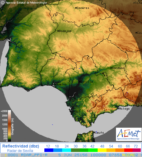
- Satellite photos: On meteoensevilla.es you can see real-time satellite images
Frequently Asked Questions
Why are some clouds white and others gray/black?
The color depends on the thickness of the cloud and the amount of light that passes through it:
- White: Thin clouds that let a lot of light through (cirrus, small cumulus)
- Gray: Thicker clouds that block part of the light (altostratus, stratocumulus)
- Black/dark: VERY thick clouds that block almost all light (nimbostratus, cumulonimbus)
The position of the sun also matters: a cloud can appear dark from below but bright white from above.
Do clouds weigh? Why don't they fall?
Yes they do! A medium-sized cumulus weighs about 500 tons (like 100 elephants).
They don't fall because:
- The droplets are MICROSCOPIC (0.01-0.02 mm) and fall very slowly
- There are updrafts that keep them up
- When the drops grow large enough (0.5 mm), they DO fall = rain
Can there be clouds without rain and rain without clouds?
Clouds without rain: Yes, most clouds do NOT produce rain (cirrus, small cumulus, stratocumulus...)
Rain without visible clouds: Rare but possible. "Rain without clouds" occurs when:
- Clouds are so high you can't see them (thick fog)
- Rain from a distant cloud that the wind carries (rare)
Conclusion
Clouds are much more than sky decoration. They are nature's early warning system, which has been working for millions of years before we invented satellites and radars.
Knowing how to identify them allows you to:
- Predict weather for the next 6-48 hours
- Know when a dangerous storm is coming
- Plan outdoor activities more safely
- Appreciate the beauty and complexity of the atmosphere
- Better understand weather maps
💡 Remember: The next time you look at the sky, you won't just see "clouds". You'll see cirrus announcing changes, cumulus promising good weather, or cumulonimbus shouting "seek shelter!". You will have learned to read the oldest book in the world: the sky.
Did you find this guide useful? Also check out our guides on Isobar Maps, DANAs and Fronts and Low-Pressure Systems.